History of California
©HistoryMaps

3000 BCE - 2023

History of California


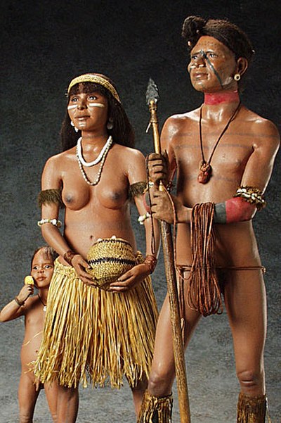
The history of California can be divided into the Native American period (about 10,000 years ago until 1542), the European exploration period (1542–1769), the Spanish colonial period (1769–1821), the Mexican Republic period (1823–1848), and United States statehood (September 9, 1850–present). California was one of the most culturally and linguistically diverse areas in pre-Columbian North America. After contact with Spanish explorers, many of the Native Americans died from foreign diseases and genocide campaigns.


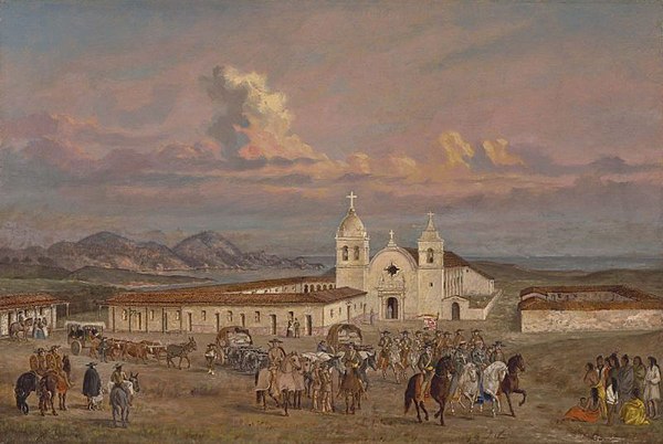
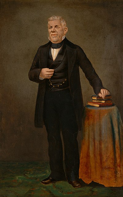
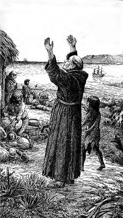
After the Portolá expedition of 1769–1770, Spanish missionaries began setting up 21 California missions on or near the coast of Alta (Upper) California, beginning with the Mission San Diego de Alcala near the location of the modern day city of San Diego, California. During the same period, Spanish military forces built several forts (presidios) and three small towns (pueblos). Two of the pueblos would eventually grow into the cities of Los Angeles and San Jose. After Mexico's Independence was won in 1821, California fell under the jurisdiction of the First Mexican Empire. Fearing the influence of the Roman Catholic church over their newly independent nation, the Mexican government closed all of the missions and nationalized the church's property. They left behind a "Californio" population of several thousand families, with a few small military garrisons. After the Mexican–American War of 1846–1848, The Mexican Republic was forced to relinquish any claim to California to the United States.


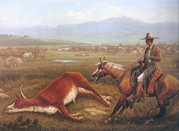
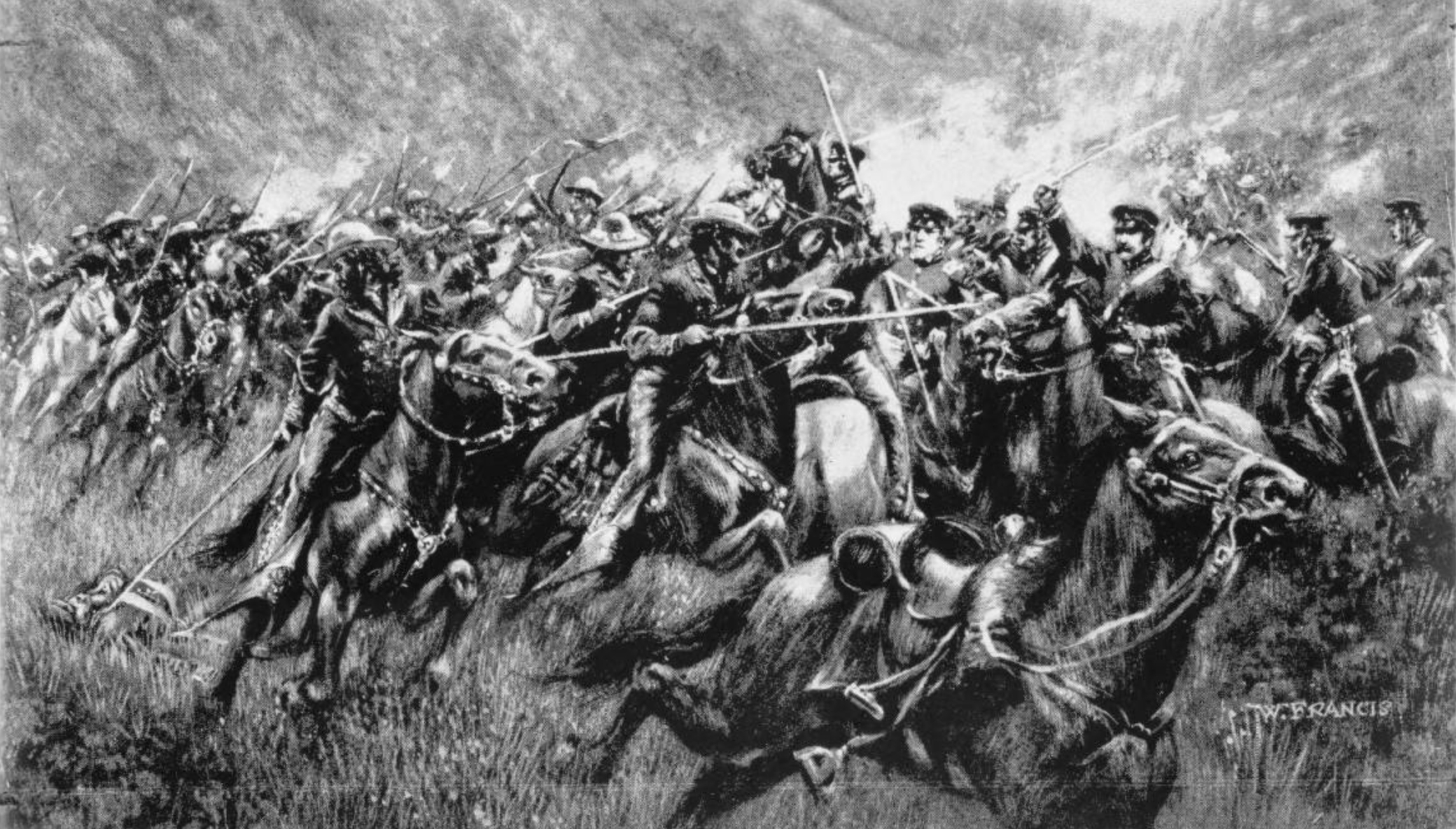
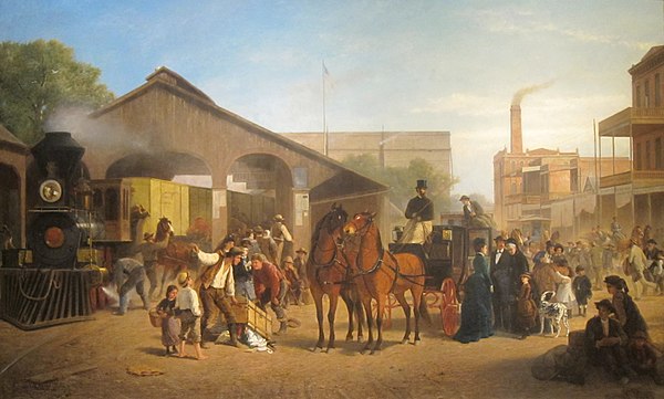
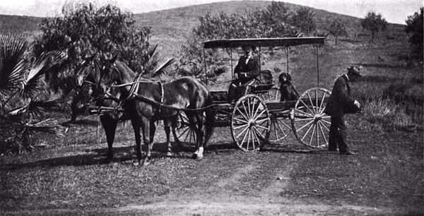
The California Gold Rush of 1848–1855 attracted hundreds of thousands of ambitious young people from around the world. Only a few struck it rich, and many returned home disappointed. Most appreciated the other economic opportunities in California, especially in agriculture, and brought their families to join them. California became the 31st U.S. state in the Compromise of 1850 and played a small role in the American Civil War. Chinese immigrants increasingly came under attack from nativists; they were forced out of industry and agriculture and into Chinatowns in the larger cities. As gold petered out, California increasingly became a highly productive agricultural society. The coming of the railroads in 1869 linked its rich economy with the rest of the nation, and attracted a steady stream of settlers. In the late 19th century, Southern California, especially Los Angeles, started to grow rapidly.

HistoryMaps Shop

Visit Shop

13000 BCE - 1542
Native American Period
ornament
Play button
13000 BCE Jan 1

Indigenous Peoples of California

California, USA

The most commonly accepted model of migration to the New World is that people from Asia crossed the Bering land bridge to the Americas some 16,500 years ago. The remains of Arlington Springs Man on Santa Rosa Island are among the traces of a very early habitation, dated to the Wisconsin glaciation (the most recent ice age) about 13,000 years ago.


Prior to European contact, some 30 tribes or culture groups lived in what is now California, gathered into perhaps six different language family groups. These groups included the early-arriving Hokan family (winding up in the mountainous far north and the Colorado River basin in the south) and the later-arriving Uto-Aztecan of the desert southeast. The California region contained the highest Native American population density north of what is now Mexico. Because of the temperate climate and easy access to food sources, approximately one-third of all Native Americans in the United States were living in the area of California.


Early Native Californians were hunter-gatherers, with seed collection becoming widespread around 9,000 BCE. Due to the local abundance of food, tribes never developed agriculture or tilled the soil. Two early southern California cultural traditions include the La Jolla complex and the Pauma Complex, both dating from c. 6050–1000 BCE. From 3000 to 2000 BCE, regional diversity developed, with the peoples making fine-tuned adaptations to local environments. Traits recognizable to historic tribes were developed by approximately 500 BCE.


The indigenous people practiced various forms of sophisticated forest gardening in the forests, grasslands, mixed woodlands, and wetlands to ensure availability of food and medicine plants. They controlled fire on a regional scale to create a low-intensity fire ecology; this prevented larger, catastrophic fires and sustained a low-density "wild" agriculture in loose rotation. By burning underbrush and grass, the natives revitalized patches of land and provided fresh shoots to attract food animals. A form of fire-stick farming was used to clear areas of old growth to encourage new in a repeated cycle; a permaculture.

Hernán Cortés
Hernán Cortés ©HistoryMaps
1535 May 3

Hernán Cortés

La Paz, BCS, Mexico

Around 1530, Nuño Beltrán de Guzmán (president of New Spain) was told by an Indian slave of the Seven Cities of Cibola that had streets paved with gold and silver. About the same time Hernán Cortés was attracted by stories of a wonderful country far to the northwest, populated by Amazonish women and abounding with gold, pearls and gems. The Spaniards conjectured that these places may be one and the same. An expedition in 1533 discovered a bay, most likely that of La Paz, before experiencing difficulties and returning. Cortés accompanied expeditions in 1534 and 1535 without finding the sought-after city. On May 3, 1535, Cortés claimed "Santa Cruz Island" (now known as the Baja California Peninsula) and laid out and founded the city that was to become La Paz later that spring.

Exploration of Baja California
Exploration of Baja California ©HistoryMaps
1539 Jul 1

Exploration of Baja California

Baja California, Mexico

In July 1539, Cortés sent Francisco de Ulloa to sail the Gulf of California with three small vessels. He made it to the mouth of the Colorado River, then sailed around the peninsula as far as Cedros Island. This proved that Baja California is a peninsula. The next year, an expedition under Hernando de Alarcón ascended the lower Colorado River to confirm Ulloa's finding. Alarcón may thus have become the first to reach Alta California. European maps published subsequently during the 16th century, including those by Gerardus Mercator and Abraham Ortelius, correctly depict Baja California as a peninsula, although some as late as the 18th century do not. The account of Ulloa's voyage marks the first-recorded application of the name "California". It can be traced to the fifth volume of a chivalric romance, Amadis de Gallia, arranged by Garci Rodríguez de Montalvo and first printed around 1510, in which a character travels through an island called "California".

1542 - 1821
Spanish Exploration and Colonization
ornament
Exploration of the California coast
Cabrillo depicted claiming California for the Spanish Empire in 1542, in a mural at Santa Barbara County Courthouse, painted by Dan Sayre Groesbeck in 1929. ©Image Attribution forthcoming. Image belongs to the respective owner(s).
1542 Jun 1

Exploration of the California coast

Cape Mendocino, California, US

Juan Rodríguez Cabrillo is believed to be the first European to explore the California coast. He was either of Portuguese or Spanish background, although his origins remain unclear. Cabrillo led an expedition in two ships of his own design and construction from the west coast of what is now Mexico, setting out in late June 1542. He landed on September 28 at San Diego Bay, claiming what he thought was the Island of California for Spain. Cabrillo named each of Californias' channel islands, which lie offshore from Baja California to northern California, as he passed them and claimed them for Spain.


Cabrillo and his crew continued north and came ashore October 8 at San Pedro bay, later to become the Port of Los Angeles, which he originally named the bay of smoke (bahia de los fumos) due to the many cooking fires of the native Chumash Indians along the shore. The expedition then continued north in an attempt to discover a supposed coastal route to the mainland of Asia. They sailed at least as far north as San Miguel Island and Cape Mendocino (north of San Francisco). Cabrillo died as the result of an accident during this voyage; the remainder of the expedition, which may have reached as far north as the Rogue River in today's southern Oregon, was led by Bartolomé Ferrer. Cabrillo and his men found that there was essentially nothing for the Spanish to easily exploit in California, located at the extreme limits of exploration and trade from Spain. The expedition depicted the indigenous populations as living at a subsistence level, typically located in small rancherias of extended family groups of 100 to 150 people.

Manila Galleons
Manila galleons. ©HistoryMaps
1565 Jan 1

Manila Galleons

Manila, Metro Manila, Philippi

In 1565, the Spanish developed a trading route where they took gold and silver from the Americas and traded it for goods and spices from China and other Asian areas. The Spanish set up their main base in Manila in the Philippines. The trade with Mexico involved an annual passage of galleons. The Eastbound galleons first went north to about 40 degrees latitude and then turned east to use the westerly trade winds and currents. These galleons, after crossing most of the Pacific Ocean, would arrive off the California coast 60 to over 120 days later, near Cape Mendocino, about 300 miles (480 km) north of San Francisco, at about 40 degrees N. latitude. They could then sail south down the California coast, utilizing the available winds and the south-flowing California Current, about 1 mi/hr (1.6 km/h). After sailing about 1,500 miles (2,400 km) south on they eventually reached their home port in Mexico. By 1700 the galleons' route turned south farther offshore and reached the California coast south of Point Conception. Often they did not land, because of the rugged, foggy coast, and they could not risk the treasure they carried.


Spain wanted a safe harbor for galleons enroute from Manilla to Acapulco. They did not find San Francisco Bay, perhaps because of fog hiding the entrance. In 1585 Gali charted the coast just south of San Francisco Bay, and in 1587 Unamuno explored Monterey Bay or Morro Bay, marking the first time in modern history when Asians (Filipino crewmen) set foot on what would be the United States. In 1594 Soromenho explored and was shipwrecked in Drake's Bay just north of San Francisco Bay, then went south in a small boat past Half Moon Bay and Monterey Bay. They traded with Native Americans for food.

Spanish Colonial Period in California
Mission San Carlos Borromeo de Carmelo, established in 1770, was the headquarters of the Californian mission system from 1797 until 1833. ©Image Attribution forthcoming. Image belongs to the respective owner(s).
1769 Jan 1 - 1821

Spanish Colonial Period in California

Baja California, Mexico

The Spanish divided California into two parts, Baja California and Alta California, as provinces of New Spain (Mexico). Baja or lower California consisted of the Baja Peninsula and terminated roughly at San Diego, California, where Alta California started. The eastern and northern boundaries of Alta California were very indefinite, as the Spanish, despite a lack of physical presence and settlements, claimed essentially everything in what is now the western United States.


The first permanent mission in Baja California, Misión de Nuestra Señora de Loreto Conchó, was founded on October 15, 1697, by Jesuit priest Juan Maria Salvatierra (1648–1717) accompanied by one small boat's crew and six soldiers. After the establishment of Missions in Alta California after 1769, the Spanish treated Baja California and Alta California, known as Las Californias, as a single administrative unit with Monterey as its capital, and falling under the jurisdiction of the Viceroyalty of New Spain based in Mexico City.


Nearly all the missions in Baja California were established by members of the Jesuit order supported by a few soldiers. After a power dispute between Charles III of Spain and the Jesuits, the Jesuit colleges were closed and the Jesuits were expelled from Mexico and South America in 1767 and deported back to Spain. After the forcible expulsion of the Jesuit order, most of the missions were taken over by Franciscan and later Dominican friars. Both of these groups were under much more direct control of the Spanish monarchy. This reorganization left many missions abandoned in Sonora Mexico and Baja California. Concerns about the intrusions of British and Russian merchants into Spain's colonies in California prompted the extension of Franciscan missions to Alta California, as well as presidios.

Play button
1769 Jan 2 - 1830

Spanish Missions

California, USA

The Spanish missions in California formed a series of 21 religious outposts or missions established between 1769 and 1833 in what is now the U.S. state of California. The missions were established by Catholic priests of the Franciscan order to evangelize indigenous peoples backed by the military force of the Spanish Empire. The missions were part of the expansion and settlement of New Spain through the formation of Alta California, expanding the empire into the most northern and western parts of Spanish North America. Civilian settlers and soldiers accompanied missionaries and formed settlements like the Pueblo de Los Ángeles.


Indigenous peoples were forced into settlements called reductions, disrupting their traditional way of life and negatively affecting as many as one thousand villages. European diseases spread in the close quarters of the missions, causing mass death. Abuse, malnourishment, and overworking were common. At least 87,787 baptisms and 63,789 deaths occurred. Indigenous peoples often resisted and rejected conversion to Christianity. Some fled the missions while others formed rebellions. Missionaries recorded frustrations with getting indigenous people to internalize Catholic scripture and practice. Indigenous girls were taken away from their parents and housed at monjeríos. The missions' role in destroying Indigenous culture has been described as cultural genocide.


By 1810, Spain's king had been imprisoned by the French, and financing for military payroll and missions in California ceased. In 1821, Mexico achieved independence from Spain, yet did not send a governor to California until 1824. The missions maintained authority over indigenous peoples and land holdings until the 1830s. At the peak of their influence in 1832, the coastal mission system controlled approximately one-sixth of Alta California. The First Mexican Republic secularized the missions with the Mexican secularization act of 1833, which emancipated indigenous peoples from the missions. Mission lands were largely given to settlers and soldiers, along with a minority of indigenous people.


The surviving mission buildings are the state of California's oldest structures and most-visited historic monuments, many of which were restored after falling into near disrepair in the early 20th century.They have become a symbol of California, appearing in many movies and television shows, and are an inspiration for Mission Revival architecture. Concerns have been raised by historians and Indigenous peoples of California about the way the mission period in California is taught in educational institutions and memorialized. The oldest European settlements of California were formed around or near Spanish missions, including the four largest: Los Angeles, San Diego, San Jose, and San Francisco.

Play button
1769 Jun 29 - 1770

Portolá Expedition

San Francisco Bay, California,

In May 1768, the Spanish Inspector General (Visitador) José de Gálvez planned a four-prong expedition to settle Alta California, two by sea and two by land, which Gaspar de Portolá volunteered to command. The Portolá land expedition arrived at the site of present-day San Diego on June 29, 1769, where it established the Presidio of San Diego and annexed the adjacent Kumeyaay village of Kosa'aay, making San Diego the first European settlement in the present state of California. Eager to press on to Monterey Bay, de Portolá and his group, consisting of Father Juan Crespí, 63 leather-jacket soldiers and a hundred mules, headed north on July 14. They reached the present-day site of Los Angeles on August 2, Santa Monica on August 3, Santa Barbara on August 19, San Simeon on September 13, and the mouth of the Salinas River on October 1. Although they were looking for Monterey Bay, the group failed to recognize it when they reached it. On October 31, de Portolá's explorers became the first Europeans known to view San Francisco Bay. Ironically, the Manila Galleons had sailed along this coast for almost 200 years by then, without noticing the bay. The group returned to San Diego in 1770. De Portolá was the first governor of Las Californias.

Play button
1775 Jan 1 - 1844

Ranchos of California

California, USA

The Spanish and Mexican governments made many concessions and land grants in Alta California and Baja California from 1775 to 1846. The Spanish Concessions of land were made to retired soldiers as an inducement for them to remain in the frontier. These Concessions reverted to the Spanish crown upon the death of the recipient. The Mexican government later encouraged settlement by issuing much larger land grants to both native-born and naturalized Mexican citizens. The grants were usually two or more square leagues, or 35 square kilometres (14 sq mi) in size. Unlike Spanish Concessions, Mexican land grants provided permanent, unencumbered ownership rights. Most ranchos granted by Mexico were located along the California coast around San Francisco Bay, inland along the Sacramento River, and within the San Joaquin Valley.


When the government secularized the Mission churches in 1833, they required that land be set aside for each Neophyte family. But the Native Americans were quickly brushed aside by Californios who, with the help of those in power, acquired the church lands as grants. The indigenous peoples of the Americas ("Indians") instead became virtual slaves of the rancheros.


Spain made about 30 concessions between 1784 and 1821, and Mexico issued about 270 land grants between 1833 and 1846. The ranchos established permanent land-use patterns. The rancho boundaries became the basis for California's land survey system, and are found on modern maps and land titles. The "rancheros" (rancho owners) patterned themselves after the landed gentry of New Spain, and were primarily devoted to raising cattle and sheep. Their workers included Native Americans who had learned Spanish while living at one of the former Missions. The ranchos were often based on access to the resources necessary for raising cattle, such as grazing lands and water. Land development from that time forward has often followed the boundaries of the ranchos, and many of their names are still in use.

Play button
1776 Mar 28

Founding of San Francisco

Mission Dolores, San Francisco

In Juan Bautista de Anza's second trip (1775–1776) he returned to California with 240 friars, soldiers and colonists with their families. They took 695 horses and mules and 385 Texas Longhorn cattle with them. The approximately 200 surviving cattle and an unknown number of horses (many of each were lost or eaten along the way) started the cattle and horse raising industry in California. In California the cattle and horses had few predators and plentiful grass in all but drought years. They essentially grew and multiplied as feral animals, doubling roughly every two years.


The expedition started from Tubac, Arizona, on October 22, 1775, and arrived at San Francisco Bay on March 28, 1776. There they selected the sites for the Presidio of San Francisco, followed by a mission, Mission San Francisco de Asís (Mission Dolores), within the future city of San Francisco, which took its name from the mission. He did not establish the settlement; it was established later by José Joaquín Moraga. While returning to Monterey, he located the original sites for Mission Santa Clara de Asis and the town of San José de Guadalupe (modern day San Jose, California), but again did not establish either settlement. Today this route is marked as the Juan Bautista de Anza National Historic Trail.

Play button
1812 Jan 1

Russians in California

Fort Ross, California, USA

The Russians established their outpost of Fort Ross in 1812 near Bodega Bay in Northern California, north of San Francisco Bay. The Fort Ross colony included a sealing station on the Farallon Islands off San Francisco. By 1818 Fort Ross had a population of 128, consisting of 26 Russians and of 102 Native Americans. Spanish concern about Russian colonial intrusion prompted the authorities in New Spain to initiate the upper Las Californias Province settlement, with presidios (forts), pueblos (towns), and the California missions. After declaring their independence in 1821 the Mexicans also asserted themselves in opposition to the Russians: the Mission San Francisco de Solano (Sonoma Mission-1823) specifically responded to the presence of the Russians at Fort Ross; and Mexico established the El Presidio Real de Sonoma or Sonoma Barracks in 1836, with General Mariano Guadalupe Vallejo as the 'Commandant of the Northern Frontier' of the Alta California Province. The fort was the northernmost Mexican outpost to halt any further Russian settlement southward. The Russians maintained it until 1841, when they left the region.

Play button
1820 Jan 1 - 1840

California Hide Trade

California, USA

The California hide trade was a trading system of various products based in cities along the California coastline, operating from the early 1820s to the mid-1840s. In exchange for hides and tallow from cattle owned by California ranchers, sailors from around the globe, often representing corporations, swapped finished goods of all kinds. The trade was the essential constituent of the region’s economy at the time, and encompassed cities extending from Canton to Lima to Boston, and involved many nations including Russia, Mexico, the United States, and the United Kingdom.

1821 - 1848
Mexican Period
ornament
Play button
1821 Jan 1 - 1848

Mexican Period in California

California, USA

In 1821, Mexico gained its independence from Spain, first as the First Mexican Empire, then as the Mexican Republic. Alta California became a territory rather than a full state. The territorial capital remained in Monterey, California, with a governor as executive official. Mexico, after independence, was unstable with about 40 changes of government, in the 27 years prior to 1848—an average government duration was 7.9 months. In Alta California, Mexico inherited a large, sparsely settled, poor, backwater province paying little or no net tax revenue to the Mexican state. In addition, Alta California had a declining Mission system as the Mission Indian population in Alta California continued to rapidly decrease. The number of Alta California settlers, always a minority of total population, slowly increased mostly by more births than deaths in the Californio population in California. After the closure of the de Anza Trail across the Colorado River in 1781 immigration from Mexico was nearly all by ship. California continued to be a sparsely populated and isolated territory.


The settlers, and their descendants (who became known as Californios), were eager to trade for new commodities, finished goods, luxury goods, and other merchandise. The Mexican government abolished the no trade with foreign ships policy and soon regular trading trips were being made. In addition, a number of Europeans and Americans became naturalized Mexican citizens and settled in early California. Some of those became rancheros and traders during the Mexican period, such as Abel Stearns.


Cattle hides and tallow, along with marine mammal fur and other goods, provided the necessary trade articles for mutually beneficial trade. The first American, English, and Russian trading ships first appeared in California a few years before 1820. From 1825 to 1848 the average number of ships traveling to California increased to about 25 ships per year—a large increase from the average of 2.5 ships per year from 1769 to 1824. The main port of entry for trading purposes was Monterey, where custom duties of up to 100% (also called tariffs) were applied.

Play button
1824 Feb 21 - Jun

Chumash Revolt

Mission Santa Inés, Mission Dr

The Chumash revolt of 1824 was an uprising of the Chumash Native Americans against the Spanish and Mexican presence in their ancestral lands. The rebellion began in 3 of the California Missions in Alta California: Mission Santa Inés, Mission Santa Barbara, and Mission La Purisima, and spread to the surrounding villages. All three missions are located in present-day Santa Barbara County, California. The Chumash revolt was the largest organized resistance movement to occur during the Spanish and Mexican periods in California.


The Chumash planned a coordinated rebellion at all three missions. Due to an incident with a soldier at Mission Santa Inés on Saturday, February 21, the rebellion began early. Most of the Santa Inés mission complex was burned down. The Chumash withdrew from Mission Santa Inés upon the arrival of military reinforcements, then attacked Mission La Purisima from inside, forced the garrison to surrender, and allowed the garrison, their families, and the mission priest to depart for Santa Inés in peace. The next day, the Chumash of Mission Santa Barbara captured the mission from within without bloodshed, repelled a military attack on the mission, and then retreated from the mission to the hills. The Chumash continued to occupy Mission La Purisima until a Mexican military unit attacked people on March 16 and forced them to surrender. Two military expeditions were sent after the Chumash in the hills; the first in April 1824 did not find an enemy to fight and returned, while the second, in June, negotiated with the Chumash and convinced a majority to return to the missions by June 28. In total, the rebellion involved as many as three hundred Mexican soldiers, six Franciscan missionaries, and two thousand Chumash and Yokuts Natives of all ages and genders.

Play button
1845 Jan 1

California Trail

California, USA

The California Trail was an emigrant trail of about 1,600 mi (2,600 km) across the western half of the North American continent from Missouri River towns to what is now the state of California. After it was established, the first half of the California Trail followed the same corridor of networked river valley trails as the Oregon Trail and the Mormon Trail, namely the valleys of the Platte, North Platte, and Sweetwater rivers to Wyoming. The trail has several splits and cutoffs for alternative routes around major landforms and to different destinations, with a combined length of over 5,000 mi (8,000 km).

Play button
1846 Jan 1 - 1873

California Genocide

California, USA

The California genocide was the killing of thousands of indigenous peoples of California by United States government agents and private citizens in the 19th century. It began following the American Conquest of California from Mexico, and the influx of settlers due to the California Gold Rush, which accelerated the decline of the indigenous population of California. Between 1846 and 1873, it is estimated that non-Natives killed between 9,492 and 16,094 California Natives. Hundreds to thousands were additionally starved or worked to death. Acts of enslavement, kidnapping, rape, child separation and displacement were widespread. These acts were encouraged, tolerated, and carried out by state authorities and militias.


The 1925 book Handbook of the Indians of California estimated that the indigenous population of California decreased from perhaps as many as 150,000 in 1848 to 30,000 in 1870 and fell further to 16,000 in 1900. The decline was caused by disease, low birth rates, starvation, killings, and massacres. California Natives, particularly during the Gold Rush, were targeted in killings. Between 10,000 and 27,000 were also taken as forced labor by settlers. The state of California used its institutions to favor white settlers' rights over indigenous rights, dispossessing natives.

Conquest of California
The Charge of the Caballeros depicts the Californio lancers at the Battle of San Pasqual. ©Image Attribution forthcoming. Image belongs to the respective owner(s).
1846 May 13 - 1847 Jan 9

Conquest of California

California, USA

The Conquest of California was an important military campaign of the Mexican–American War carried out by the United States in Alta California, then a part of Mexico. The conquest lasted from 1846 into 1847, until military leaders from both the Californios and Americans signed the Treaty of Cahuenga, which ended the conflict in California.

Play button
1846 Jun 14

Bear Flag Revolt

Sonoma, CA, USA

The Bear Flag Revolt was a revolt that occurred in California in 1846. It was a revolt against the Mexican government, which had been in control of the area since 1822. The revolt was led by a small group of American settlers, who raised a flag featuring a grizzly bear and a star to symbolize their independence. The revolt was successful and California eventually joined the United States in 1850. The revolt began when a group of settlers led by William B. Ide captured the Mexican garrison at Sonoma, California. Ide and his followers then declared California to be an independent republic and raised the Bear Flag. The revolt quickly gained momentum, as other settlers joined in and the Mexican troops were unable to counter the revolt. Within days, a force of American settlers and U.S. Navy ships arrived in California and the Mexican forces were defeated. The Bear Flag Republic was short-lived, however, as the U.S. government soon asserted control over the area. California was ultimately annexed by the United States in 1850, ending the Bear Flag Revolt.

1848 - 1850
California Gold Rush and Statehood
ornament
Play button
1848 Jan 1

California Oil Industry

San Joaquin Valley, California

California pioneers after 1848 discovered an increasing number of oil seeps—oil seeping to the surface, especially in Humboldt, Colusa, Santa Clara, and San Mateo counties, and in the asphaltum seeps and bituminous residues in Mendocino, Marin, Contra Costa, Santa Clara, and Santa Cruz counties. In southern California, large seeps in Ventura, Santa Barbara, Kern, and Los Angeles counties received the most attention. Interest in oil and gas seeps was stirred in the 1850s and 1860s, becoming widespread after the 1859 commercial uses of oil were demonstrated in Pennsylvania. Kerosene quickly replaced whale oil for lighting, and lubricating oils became an essential product in the Machine Age. Other uses later in the 19th century included providing paving material for many roads and providing power for many steam locomotives and steam-powered shipping—replacing coal.


Oil became a major California industry in the 20th century with the discovery of new fields around Los Angeles and the San Joaquin Valley, and the dramatic explosion in demand for gasoline to fuel the rapidly growing number of automobiles and trucks now being produced. Most of the oil production in California began in the late 19th century. At the turn of the century, oil production in California continued to rise at a booming rate. In 1900, the state of California produced 4 million barrels. In 1903, California became the leading oil-producing state in the US, and traded the number one position back and forth with Oklahoma through 1930. Production at the various oil fields increased to about 34 million barrels per year by 1904. By 1910 production had reached 78 million barrels. California drilling operations and oil production are concentrated primarily in Kern County, the San Joaquin Valley, and the Los Angeles Basin.

Play button
1848 Jan 24 - 1855

California Gold Rush

Northern California, CA, USA

The California Gold Rush (1848–1855) was a gold rush that began on January 24, 1848, when gold was found by James W. Marshall at Sutter's Mill in Coloma, California. The news of gold brought approximately 300,000 people to California from the rest of the United States and abroad. The sudden influx of gold into the money supply reinvigorated the American economy; the sudden population increase allowed California to go rapidly to statehood in the Compromise of 1850. The Gold Rush had severe effects on Native Californians and accelerated the Native American population's decline from disease, starvation and the California genocide.


The effects of the Gold Rush were substantial. Whole indigenous societies were attacked and pushed off their lands by the gold-seekers, called "forty-niners" (referring to 1849, the peak year for Gold Rush immigration). Outside of California, the first to arrive were from Oregon, the Sandwich Islands (Hawaii) and Latin America in late 1848. Of the approximately 300,000 people who came to California during the Gold Rush, about half arrived by sea and half came overland on the California Trail and the Gila River trail; forty-niners often faced substantial hardships on the trip. While most of the newly arrived were Americans, the gold rush attracted thousands from Latin America, Europe, Australia and China. Agriculture and ranching expanded throughout the state to meet the needs of the settlers. San Francisco grew from a small settlement of about 200 residents in 1846 to a boomtown of about 36,000 by 1852. Roads, churches, schools and other towns were built throughout California. New methods of transportation developed as steamships came into regular service. By 1869, railroads were built from California to the eastern United States. At its peak, technological advances reached a point where significant financing was required, increasing the proportion of gold companies to individual miners. Gold worth tens of billions of today's US dollars was recovered, which led to great wealth for a few, though many who participated in the California Gold Rush earned little more than they had started with.

Early California Transportation
The most famous era of the clipper ships was during the California Gold Rush in the late 1840s and early 1850s. ©HistoryMaps
1848 Oct 6

Early California Transportation

California, USA

The first of three Pacific Mail Steamship Company paddle wheel steamships, the SS California (1848), contracted for on the Pacific route, left New York City on 6 October 1848. This was before the gold strikes in California were confirmed and she left with only a partial passenger load in her 60 saloon (about $300 fare) and 150 steerage (about $150 fare) passenger compartments. Only a few were going all the way to California. As word of the gold strikes spread, the SS California picked up more passengers in Valparaiso Chile and Panama City Panama and showed up in San Francisco on 28 February 1849. She was loaded with about 400 gold seeking passengers; twice the number of passengers it had been designed for. In San Francisco all her passengers and crew except the captain and one man deserted the ship and it would take the Captain two more months to gather a much better paid return crew to return to Panama city an establish the route they had been contracted for. Many more paddle steamers were soon running from the east coast cities to the Chagres River in Panama and the San Juan River in Nicaragua. By the mid 1850s there were over ten Pacific and ten Atlantic/Caribbean paddle wheel steamboats shuttling high valued freight like passengers, gold and mail between California and both the Pacific and Caribbean ports. The trip to the east coast could be executed after about 1850 in as short as 40 days if all ship connections could be met with a minimum of waiting.


Steamboats plied the Bay Area and the Sacramento and San Joaquin Rivers that flowed nearer the goldfields, moving passengers and supplies from San Francisco to Sacramento, Marysville and Stockton, California—the three main cities supplying the gold fields. The city of Stockton, on the lower San Joaquin, quickly grew from a sleepy backwater to a thriving trading center, the stopping-off point for miners headed to the gold fields in the foothills of the Sierra. Rough ways such as the Millerton Road which later became the Stockton–Los Angeles Road quickly extended the length of the valley and were served by mule teams and covered wagons. Riverboat navigation quickly became an important transportation link on the San Joaquin River, and during the "June Rise", as boat operators called the San Joaquin's annual high water levels during snow melt, on a wet year large craft could make it as far upstream as Fresno. During the peak years of the gold rush, the river in the Stockton area was reportedly crowded with hundreds of abandoned oceangoing craft, whose crew had deserted for the gold fields. The multitude of idle ships was such a blockade that at several occasions they were burned just to clear a way for riverboat traffic. Initially, with few roads, pack trains and wagons brought supplies to the miners. Soon a system of wagon roads, bridges, ferries and toll roads were set up many of them maintained by tolls collected from the users. Large freight wagons pulled by up to 10 mules replaced pack trains, and toll roads built and kept passable by the tolls made it easier to get to the mining camps, enabling express companies to deliver firewood, lumber, food, equipment, clothes, mail, packages, etc. to the miners. Later when communities developed in Nevada some steamboats were even used to haul cargo up the Colorado River as high as where Lake Mead in Nevada is today.

1850
Modern Period
ornament
State of California
State of California. ©HistoryMaps
1850 Sep 9

State of California

San Jose, CA, USA

The California Constitution was ratified by popular vote at an election held on a rainy November 13, 1849. The Pueblo de San Jose was chosen as the first state capital. Soon after the election they set up a provisional state government that set up the counties, elected a governor, senators, and representatives, and operated for ten months prior to statehood. As agreed to in the Compromise of 1850, Congress passed the California Statehood Act on September 9, 1850. Thirty-eight days later the Pacific Mail Steamship SS Oregon brought word to San Francisco on October 18, 1850, that California was now the 31st state. There was a celebration that lasted for weeks. The state capital was variously at San Jose (1850–1851), Vallejo (1852–1853), and Benicia (1853–1854) until Sacramento was finally selected in 1854.

California Naval Bases
©Image Attribution forthcoming. Image belongs to the respective owner(s).
1851 Jan 1

California Naval Bases

Mare Island Naval Shipyard, Va

Mare Island, near the city of Vallejo, California, was first Naval Base in California. The Napa River forms its eastern side as it enters the Carquinez Strait juncture with the east side of San Pablo Bay. In 1850, Commodore John Drake Sloat, in charge of a commission to find a California naval base, recommended the island across the Napa River from the settlement of Vallejo; it being "free from ocean gales and from floods and freshets."


On 6 November 1850, two months after California was admitted to statehood, President Millard Fillmore reserved Mare Island for government use. The U.S. Navy Department acted favorably on Commodore Sloat's recommendations and Mare Island was purchased in July 1852, for the sum of $83,410 for the use as a naval shipyard. Two years later, on 16 September 1854, Mare Island became the first permanent U.S. naval installation on the west coast, with Commodore David G. Farragut, as Mare Island's first base commander. For more than a century, Mare Island served as the United States Navy's Mare Island Naval Shipyard.


Before World War II, Mare Island had been in a continual state of upbuilding. Then came Pearl Harbor. In 1941, the drafting department had expanded to three buildings accommodating over 400 Naval architects, engineers and draftsmen. Mare Island became one of the U.S. Navy's ship building sites in World War II specializing in building diesel engine powered submarines—they eventually built 32 of them. After the war was over Mare Island became a premier site for building nuclear-powered submarines—building 27 of them.


Naval Base San Diego was started on land acquired in 1920. San Diego has become the home port of the largest naval fleet in the world, and includes two supercarriers, as well as U.S. Marine Corps stations, U.S. Navy ports, and U.S. Coast Guard installations. Naval Base San Diego is the largest base of the United States Navy on the west coast of the United States, in San Diego, California. Naval Base San Diego is the principal homeport of the Pacific Fleet, consisting of 54 ships and over 120 tenant commands. The base is composed of 13 piers stretched over 977 acres (3.95 km2) of land and 326 acres (1.32 km2) of water. The total on base population is 20,000 military personnel and 6,000 civilians.

Play button
1855 Feb 1

California Railroads

California, USA

California's first railroad was built from Sacramento to Folsom, California starting in February 1855. This 22-mile (35 km) line was meant to take advantage of the prosperous gold diggings in Placerville, California but were completed at about the same time (February 1856) as the mining near there came to an end. The first Transcontinental Railroad from Sacramento, California to Omaha, Nebraska was completed on May 9, 1869. The Central Pacific Railroad, the Pacific end of the railroad, largely took over nearly all freight across the Sierra Nevada mountains in Northern California. By 1870 there were railroad connections to Oakland, California and via a train ferry to San Francisco, California from Sacramento—effectively connecting all the major cities in California then to the east coast.


Southern California's first railroad, the Los Angeles & San Pedro Railroad, was inaugurated in October 1869 by John G. Downey and Phineas Banning. It ran 21 miles (34 km) between San Pedro and Los Angeles. In 1876 California's first railroad linking Los Angeles with Northern California was completed when the San Joaquin line of the Southern Pacific Railroad finished the San Fernando Railroad Tunnel through the Tehachapi mountains, linking Los Angeles to the Central Pacific Railroad. This route to Los Angeles followed the Tehachapi Loop, a 0.73-mile (1.17 km) long 'spiral track', or helix, through Tehachapi Pass in Kern County and connected Bakersfield and the San Joaquin Valley to Mojave in the Mojave Desert.


Although most of California's railroads started off as short line railroads the period from 1860 to 1903 saw a series of railroad mergers and acquisitions that led to the creation of four major inter-state railroads servicing the state (the Southern Pacific Railroad, Union Pacific Railroad, Santa Fe Railroad and Western Pacific Railroad). Each of these railroads controlled one (and Southern Pacific controlled two) of the transcontinental railroads which linked California with states farther East. The railroads moved freight and passengers in large quantities and allowed the state's economy and population to expand rapidly during the late 19th and early 20th centuries.


By the 1890s the construction of electric railroads had begun in California and by the early 20th century several systems existed to serve California's largest cities. The state's electric railroad systems included the San Diego Electric Railway, Los Angeles' Pacific Electric system, the Los Angeles Pacific Railroad, East Bay Electric Lines and the San Francisco, Oakland, and San Jose Railway and Interurban rail systems such as the Sacramento Northern Railway were also constructed. By the 1920s, Los Angeles' Pacific Electric system was the largest electric railroad in the world.

Butterfield Overland Mail
Overland Mail Coach. ©HistoryMaps
1858 Jan 1 - 1861

Butterfield Overland Mail

San Francisco, CA, USA

Butterfield Overland Mail (officially the Overland Mail Company) was a stagecoach service in the United States operating from 1858 to 1861. It carried passengers and U.S. Mail from two eastern termini, Memphis, Tennessee, and St. Louis, Missouri, to San Francisco, California. The routes from each eastern terminus met at Fort Smith, Arkansas, and then continued through Indian Territory (Oklahoma), Texas, New Mexico, Arizona, Mexico, and California ending in San Francisco. On March 3, 1857, Congress authorized the U.S. postmaster general, at that time Aaron V. Brown, to contract for delivery of the U.S. mail from St. Louis to San Francisco. Prior to this, U.S. Mail bound for the Far West had been delivered by the San Antonio and San Diego Mail Line (Jackass Mail) since June 1857.

Mendocino War
The Mendocino War was a conflict between the Yuki and white settlers in Mendocino County, California. ©HistoryMaps
1859 Jul 1 - 1860 Jan 18

Mendocino War

Mendocino County, California,

The Mendocino War was a conflict between the Yuki (mainly Yuki tribes) and white settlers in Mendocino County, California between July 1859 and January 18, 1860. It was caused by settler intrusion and slave raids on native lands and subsequent native retaliation, resulting in the deaths of hundreds of Yuki.


In 1859, a band of locally sponsored rangers led by Walter S. Jarboe, called the Eel River Rangers, raided the countryside in an effort to remove the natives from settler territory and move them onto the Nome Cult Farm, an area near the Mendocino Indian Reservation. By the time the Eel River Rangers were disbanded in 1860, Jarboe and his men had killed 283 warriors, captured 292, killed countless women and children, and only suffered 5 casualties themselves in just 23 engagements. The bill to the state for the rangers' services amounted to $11,143.43. Scholars, however, state that the damage to the area and natives in particular was even higher than reported, especially given the vast number of raiding parties formed outside of the Eel River Rangers.


Other settlers formed their own raiding parties against the natives, joining Jarboe in his mission to rid Round Valley of its native population. Those that survived were moved to the Nome Cult Farm, where they experienced hardships typical of the reservation system of the day. After the conflict, contemporaries claimed that the conflict was more of a slaughter than a war, and later historians have labeled it a genocide.

Pony Express
Pony Express ©Image Attribution forthcoming. Image belongs to the respective owner(s).
1860 Apr 3 - 1861 Oct 26

Pony Express

California, USA

The Pony Express was an American express mail service that used relays of horse-mounted riders. It operated from April 3, 1860, to October 26, 1861, between Missouri and California. It was operated by the Central Overland California and Pikes Peak Express Company.


During its 18 months of operation, the Pony Express reduced the time for messages to travel between the east and west US coast to about 10 days. It became the west's most direct means of east–west communication before the first transcontinental telegraph was established (October 24, 1861), and was vital for tying the new U.S. state of California with the rest of the United States.


Despite a heavy subsidy, the Pony Express was not a financial success and went bankrupt in 18 months, when a faster telegraph service was established. Nevertheless, it demonstrated that a unified transcontinental system of communications could be established and operated year-round. When replaced by the telegraph, the Pony Express quickly became romanticized and became part of the lore of the American West. Its reliance on the ability and endurance of hardy riders and fast horses was seen as evidence of rugged American individualism of the frontier times.

Play button
1861 Jan 1 - 1865

California in the American Civil War

California, USA

California's involvement in the American Civil War included sending gold east to support the war effort, recruiting volunteer combat units to replace regular U.S. Army units sent east, in the area west of the Rocky Mountains, maintaining and building numerous camps and fortifications, suppressing secessionist activity (many of these secessionists went east to fight for the Confederacy) and securing the New Mexico Territory against the Confederacy. The State of California did not send its units east, but many citizens traveled east and joined the Union Army there, some of whom became famous.


Democrats had dominated the state from its inception, and Southern Democrats were sympathetic to secession. Although they were a minority in the state, they had become a majority in Southern California and Tulare County, and large numbers resided in San Joaquin, Santa Clara, Monterey, and San Francisco counties. California was home for powerful businessmen who played a significant role in Californian politics through their control of mines, shipping, finance, and the Republican Party but Republicans had been a minority party until the secession crisis. The Civil War split in the Democratic Party allowed Abraham Lincoln to carry the state, albeit by only a slim margin. Unlike most free states, Lincoln won California with only a plurality as opposed to the outright majority in the popular vote.


In the beginning of 1861, as the secession crisis began, the secessionists in San Francisco made an attempt to separate the state and Oregon from the union, which failed. Southern California, with a majority of discontented Californios and Southern secessionists, had already voted for a separate Territorial government and formed militia units, but were kept from secession after the outbreak of war by Federal troops drawn from the frontier forts of the District of Oregon and District of California (primarily Fort Tejon and Fort Mojave).


Patriotic fervor swept California after the attack on Fort Sumter, providing the manpower for Volunteer Regiments recruited mainly from the pro-Union counties in the north of the State. Gold was also provided to support the Union. When the Democratic party split over the war, Republican supporters of Lincoln took control of the state in the September elections. Volunteer Regiments were sent to occupy pro-secessionist Southern California and Tulare County, leaving them generally powerless during the war itself. However some Southerners traveled east to join the Confederate Army, evading Union patrols and hostile Apache. Others remaining in the state attempted to outfit a privateer to prey on coastal shipping, and late in the war two groups of partisan rangers were formed but neither were successful.

Play button
1882 May 6

Chinese Exclusion Act

California, USA

The Chinese Exclusion Act was a United States federal law signed by President Chester A. Arthur on May 6, 1882, prohibiting all immigration of Chinese laborers for 10 years. The law excluded merchants, teachers, students, travelers, and diplomats. Building on the earlier Page Act of 1875, which banned Chinese women from migrating to the United States, the Chinese Exclusion Act was the only law ever implemented to prevent all members of a specific ethnic or national group from immigrating to the United States.


Passage of the law was preceded by growing anti-Chinese sentiment and anti-Chinese violence, as well as various policies targeting Chinese migrants. The act followed the Angell Treaty of 1880, a set of revisions to the U.S.–China Burlingame Treaty of 1868 that allowed the U.S. to suspend Chinese immigration. The act was initially intended to last for 10 years, but was renewed and strengthened in 1892 with the Geary Act and made permanent in 1902. These laws attempted to stop all Chinese immigration into the United States for ten years, with exceptions for diplomats, teachers, students, merchants, and travelers. They were widely evaded.


The law remained in force until the passage of the Magnuson Act in 1943, which repealed the exclusion and allowed 105 Chinese immigrants to enter the United States each year. Chinese immigration later increased with the passage of the Immigration and Nationality Act of 1952, which abolished direct racial barriers, and later by the Immigration and Nationality Act of 1965, which abolished the National Origins Formula.

Progressive Era
Busy Market Street of the City of the Golden Gate, San Francisco, Calif. (ca. 1901) UC Riverside, California Museum of Photography ©Image Attribution forthcoming. Image belongs to the respective owner(s).
1890 Jan 1 - 1920

Progressive Era

California, USA

California was a leader in the Progressive Movement from the 1890s into the 1920s. A coalition of reform-minded Republicans, especially in southern California, coalesced around Thomas Bard (1841–1915). Bard's election in 1899 as United States senator enabled the anti-machine Republicans to sustain a continuing opposition to the Southern Pacific Railway's political power in California. They helped nominate George C. Pardee for governor in 1902 and formed the "Lincoln–Roosevelt League". In 1910 Hiram W. Johnson won the campaign for governor under the slogan "Kick the Southern Pacific out of politics." In 1912 Johnson became the running mate for Theodore Roosevelt on the new Bull Moose Party ticket. By 1916 the Progressives were supporting labor unions, which helped them in ethnic enclaves in the larger cities but alienated the native-stock Protestant, middle-class voters who voted heavily against Senator Johnson and President Wilson in 1916.


Political progressivism varied across the state. Los Angeles (population 102,000 in 1900) focused on the dangers posed by the Southern Pacific Railroad, the liquor trade, and labor unions; San Francisco (population 342,000 in 1900) was confronted with a corrupt union-backed political "machine" that was finally overthrown following the earthquake of 1906. Smaller cities like San Jose (which had a population of 22,000 in 1900) had somewhat different concerns, such as fruit cooperatives, urban development, rival rural economies, and Asian labor. San Diego (population 18,000 in 1900) had both the Southern Pacific and a corrupt machine.

California's State Highway System
The Bureau of Highways with their buckboard wagon in Riverside County, 1896 ©Image Attribution forthcoming. Image belongs to the respective owner(s).
1896 Jan 1

California's State Highway System

California, USA

Automobile travel became important after 1910 when motor cars and trucks began to become common. Before that nearly all long-distance travel was by railroad or stagecoach, with horse- or mule-drawn wagons hauling the freight. A key route was the Lincoln Highway, which was America's first transcontinental road for motorized vehicles, connecting New York City to San Francisco. The state highway system in the U.S. state of California dates back to 1896, when the state took over maintenance of the Lake Tahoe Wagon Road. Before then, roads and streets were managed exclusively by local governments. Construction of a statewide highway system began in 1912, after the state's voters approved an $18 million bond issue for over 3,000 miles (4900 km) of highways. The creation of the Lincoln Highway in 1913 was a major stimulus on the development of both industry and tourism in the state. The last large addition was made by the California State Assembly in 1959, after which only minor changes have been made

Play button
1906 Apr 18

San Francisco Earthquake

San Francisco, CA, USA

At 05:12 Pacific Standard Time on Wednesday, April 18, 1906, the coast of Northern California was struck by a major earthquake with an estimated moment magnitude of 7.9 and a maximum Mercalli intensity of XI (Extreme). High-intensity shaking was felt from Eureka on the North Coast to the Salinas Valley, an agricultural region to the south of the San Francisco Bay Area. Devastating fires soon broke out in San Francisco and lasted for several days. More than 3,000 people died, and over 80% of the city was destroyed. The events are remembered as one of the worst and deadliest earthquakes in the history of the United States. The death toll remains the greatest loss of life from a natural disaster in California's history and high on the lists of American disasters.

Play button
1910 Dec 23

California Aerospace History

California, USA

After Wilbur and Orville Wright demonstrated the feasibility of controlled manned flight, Glenn Curtiss entered the field, focusing on aircraft manufacturing and pilot training. On December 23, 1910, Lieut. T. Gordon "Spuds" Ellyson was ordered to report to the Glenn Curtiss Aviation Camp at North Island in San Diego. He completed his training April 12, 1911, and became Naval Aviator No. 1. The original site of this winter encampment is now part of Naval Air Station North Island in San Diego and is referred to by the Navy as "The Birthplace of Naval Aviation". On January 18, 1911, at 11:01 a.m., Eugene Ely, flying a Curtiss pusher, landed on a specially built platform aboard the armored cruiser USS Pennsylvania at anchor in San Francisco Bay. At 11:58 a.m., he took off and returned to Selfridge Field, San Francisco.


Caltech in Pasadena provided an ideal situation for the development and manufacture of aircraft. In 1925, aircraft builder Donald Douglas and Los Angeles Times publisher Harry Chandler worked together with Caltech president Robert Millikan to bring a state-of-the-art aeronautical research laboratory to the Pasadena college. Douglas recruited some of Caltech's best and brightest students for his company. Douglas utilized the lab's wind tunnel and research staff while designing his DC-1, 2, and 3. In this way, the DC-3, undoubtedly one of the most successful aircraft designs ever built, represented more than just a single designer's project.


The Caltech Jet Propulsion Laboratory (JPL) traces its beginnings to 1936 in the Guggenheim Aeronautical Laboratory at the California Institute of Technology (GALCIT), when the first set of rocket experiments were carried out in the Arroyo Seco. JPL was transferred to NASA in December 1958, becoming the agency's primary planetary spacecraft center. In 1940, 65% of aircraft manufacturers were located along or near the East or West Coasts of the United States. California alone had 44 percent of all aircraft manufacturing.

Play button
1911 Jan 1

Women's Suffrage in California

California, USA

Women's suffrage in California refers to the political struggle for voting rights for women in the state of California. The movement began in the 19th century and was successful with the passage of Proposition 4 on October 10, 1911. Many of the women and men involved in this movement remained politically active in the national suffrage movement with organizations such as the National American Women's Suffrage Association and the National Woman's Party.

Play button
1913 Jan 1

California Alien Land Law of 1913

California, USA

The California Alien Land Law of 1913 (also known as the Webb–Haney Act) prohibited "aliens ineligible for citizenship" from owning agricultural land or possessing long-term leases over it, but permitted leases lasting up to three years. It affected the Chinese, Indian, Japanese, and Korean immigrant farmers in California. Implicitly, the law was primarily directed at the Japanese. It passed 35–2 in the State Senate and 72–3 in the State Assembly and was co-written by attorney Francis J. Heney and California state attorney general Ulysses S. Webb at the behest of Governor Hiram Johnson. Japan's Consul General Kametaro Iijima and lawyer Juichi Soyeda lobbied against the law. In a letter to the United States Secretary of State, the Japanese government via the Japanese Minister of Foreign Affairs called the law "essentially unfair and inconsistent... with the sentiments of amity and good neighborhood which have presided over the relations between the two countries," and noted that Japan felt it was "in disregard of the spirit of the existing treaty between Japan and the United States." The law was meant to discourage immigration from Asia, and to create an inhospitable climate for immigrants already living in California. The law was overturned by the California Supreme Court as unconstitutional in 1952.

Hollywood
Harold Lloyd in the clock scene from Safety Last! (1923) ©Image Attribution forthcoming. Image belongs to the respective owner(s).
1913 Jan 1

Hollywood

Hollywood, Los Angeles, CA, US

The cinema of the United States, consisting mainly of major film studios (also known metonymously as Hollywood) along with some independent film, has had a large effect on the global film industry since the early 20th century. The dominant style of American cinema is classical Hollywood cinema, which developed from 1913 to 1969 and is still typical of most films made there to this day. While Frenchmen Auguste and Louis Lumière are generally credited with the birth of modern cinema, American cinema soon came to be a dominant force in the emerging industry. Hollywood is considered to be the oldest film industry, in the sense of being the place where the earliest film studios and production companies emerged. It is the birthplace of various genres of cinema—among them comedy, drama, action, the musical, romance, horror, science fiction, and the war epic—and has set the example for other national film industries. Since the early 20th century, the U.S. film industry has largely been based in and around the thirty-mile zone in Hollywood, Los Angeles, California. Director D.W. Griffith was central to the development of a film grammar. Orson Welles's Citizen Kane (1941) is frequently cited in critics' polls as the greatest film of all time. The major film studios of Hollywood are the primary source of the most commercially successful and most ticket selling movies in the world. Many of Hollywood's highest-grossing movies have generated more box-office revenue and ticket sales outside the United States than films made elsewhere. The United States is a leading pioneer in motion picture engineering and technology.

Play button
1913 Nov 1

Los Angeles Aqueduct

Owens Valley, California, USA

The Los Angeles Aqueduct system, comprising the Los Angeles Aqueduct (Owens Valley aqueduct) and the Second Los Angeles Aqueduct, is a water conveyance system, built and operated by the Los Angeles Department of Water and Power. The Owens Valley aqueduct was designed and built by the city's water department, at the time named The Bureau of Los Angeles Aqueduct, under the supervision of the department's Chief Engineer William Mulholland. The system delivers water from the Owens River in the Eastern Sierra Nevada Mountains to Los Angeles, California. The aqueduct's construction was controversial from the start, as water diversions to Los Angeles eliminated the Owens Valley as a viable farming community. Clauses in the city's charter originally stated that the city could not sell or provide surplus water to any area outside the city, forcing adjacent communities to annex themselves into Los Angeles.The aqueduct's infrastructure also included the completion of the St. Francis Dam in 1926 to provide storage in case of disruption to the system. The dam's collapse two years later killed at least 431 people, halted the rapid pace of annexation, and eventually led to the formation of the Metropolitan Water District of Southern California to build and operate the Colorado River Aqueduct to bring water from the Colorado River to Los Angeles County.The continued operation of the Los Angeles Aqueduct has led to public debate, legislation, and court battles over its environmental impacts on Mono Lake and other ecosystems. == First Los Angeles Aqueduct == === Construction === The aqueduct project began in 1905 when the voters of Los Angeles approved a US$1.5 million bond for the 'purchase of lands and water and the inauguration of work on the aqueduct'. On June 12, 1907, a second bond was passed with a budget of US$24.5 million to fund construction.Construction began in 1908 and was divided into eleven divisions. The city acquired three limestone quarries, two Tufa quarries and it constructed and operated a cement plant in Monolith, California which could produce 1,200 barrels of Portland cement per day.

World War I
FWD 'Model B', 3-ton, 4x4 truck ©Image Attribution forthcoming. Image belongs to the respective owner(s).
1914 Jan 1 - 1918

World War I

California, USA

California played a major role in terms of agriculture, industry, finance and propaganda during World War I. Its industrialized agriculture exported food to the Allies, 1914–1917, and expanded again when America entered the war in 1917. After the war ended, it shipped large quantities of food to central Europe as part of national relief efforts. Hollywood was thoroughly engaged, with feature films and training films. Attractive climate conditions led to the addition of numerous Army and Navy training camps and airfields. Construction of transports and warships boosted the economy of the Bay area.

O'Shaughnessy Dam
Construction work on the dam in August 1922 ©Image Attribution forthcoming. Image belongs to the respective owner(s).
1923 Jan 1

O'Shaughnessy Dam

Tuolumne County, California, U

In 1923, the O'Shaughnessy Dam was completed on the Tuolumne River, flooding the entire valley under the Hetch Hetchy Reservoir. The dam and reservoir are the centerpiece of the Hetch Hetchy Project, which in 1934 began to deliver water 167 miles (269 km) west to San Francisco and its client municipalities in the greater San Francisco Bay Area.

Growth after World War II
A look back at the opening days of the Disneyland theme park, in Anaheim, California, in 1955. ©Image Attribution forthcoming. Image belongs to the respective owner(s).
1945 Jan 1

Growth after World War II

California, USA

After the war, hundreds of land developers bought land cheap, subdivided it, built on it, and got rich. Real estate development replaced oil and agriculture as southern California's principal industry. In 1955, Disneyland opened in Anaheim. In 1958, Major League Baseball's Dodgers and Giants left New York City and came to Los Angeles and San Francisco, respectively. The population of California expanded dramatically, to nearly 20 million by 1970.


California's growth after World War II was fueled in part by an arms race with the Soviets and the growing defense industry. In 1962, about 40 percent of the nation's 6-billion dollar military research contracts went into California for testing technology such as planes and bombs.

Play button
1950 Jan 1

High-tech Expansion

Santa Clara Valley, San Jose,

Starting in the 1950s, high technology companies in northern California began a spectacular growth that continued through the end of the 20th century. The major products included personal computers, video games, and networking systems. The majority of these companies settled along a highway stretching from Palo Alto to San Jose, notably including Santa Clara and Sunnyvale, all in the Santa Clara Valley, the so-called "Silicon Valley", named after the material used to produce the integrated circuits of the era.


This era peaked in 2000, by which time demand for skilled technical professionals had become so high that the high-tech industry had trouble filling all of its positions and therefore pushed for increased visa quotas so that they could recruit from overseas. When the "Dot-com bubble" burst in 2001, jobs evaporated overnight, and for the first time over the next two years more people moved out of the area than moved in. This somewhat mirrored the collapse of the aerospace industry in southern California some twenty years earlier.

California Master Plan for Higher Education
UCLA ©Image Attribution forthcoming. Image belongs to the respective owner(s).
1960 Jan 1

California Master Plan for Higher Education

California, USA

The California Master Plan for Higher Education of 1960 was developed by a survey team appointed by the Regents of the University of California and the California State Board of Education during the administration of Governor Pat Brown. UC President Clark Kerr was a key figure in its development. The Plan set up a coherent system for public postsecondary education which defined specific roles for the already-existing University of California (UC), the state colleges which were joined together by the Plan into the State College System of California and later renamed the California State University (CSU), and the junior colleges which were later organized in 1967 into the California Community Colleges (CCC) system.

Play button
1965 Aug 11 - 1962 Aug 15

Watts Riots

Watts, Los Angeles, CA, USA

On August 11, 1965, Marquette Frye, a 21-year-old African-American man, was pulled over for drunken driving. After he failed a field sobriety test, officers attempted to arrest him. Marquette resisted arrest, with assistance from his mother, Rena Frye; a physical confrontation ensued in which Marquette was struck in the face with a baton. Meanwhile, a crowd of onlookers had gathered. Rumors spread that the police had kicked a pregnant woman who was present at the scene. Six days of civil unrest followed, motivated in part by allegations of police abuse. Nearly 14,000 members of the California Army National Guard helped suppress the disturbance, which resulted in 34 deaths, as well as over $40 million in property damage. It was the city's worst unrest until the Rodney King riots of 1992.

Play button
1992 Apr 1 - May

1992 Los Angeles Riots

Los Angeles County, California

The 1992 Los Angeles riots, sometimes called the Rodney King riots or the 1992 Los Angeles uprising, were a series of riots and civil disturbances that occurred in Los Angeles County, California, in April and May 1992. Unrest began in South Central Los Angeles on April 29, after a jury acquitted four officers of the Los Angeles Police Department (LAPD) charged with using excessive force in the arrest and beating of Rodney King. This incident had been videotaped and widely shown in television broadcasts.


The rioting took place in several areas in the Los Angeles metropolitan area as thousands of people rioted over six days following the verdict's announcement. Widespread looting, assault, and arson occurred during the riots, which local police forces had difficulty controlling. The situation in the Los Angeles area was resolved only after the California National Guard, United States military, and several federal law enforcement agencies deployed more than 5,000 federal troops to assist in ending the violence and unrest.


When the riots ended, 63 people had been killed, 2,383 had been injured, more than 12,000 had been arrested, and estimates of property damage were over $1 billion. Koreatown, situated just to the north of South Central LA, was disproportionately damaged. Much of the blame for the extensive nature of the violence was attributed to LAPD Chief of Police Daryl Gates, who had already announced his resignation by the time of the riots, for failure to de-escalate the situation and overall mismanagement.

Characters


Glenn Curtiss

Glenn Curtiss

Founder of the U.S. Aircraft Industry

Chumash people

Chumash people

Native American People

Juan Bautista Alvarado

Juan Bautista Alvarado

Governor of the Californias

Gaspar de Portolá

Gaspar de Portolá

Spanish Military Officer

John C. Frémont

John C. Frémont

American Military Officer

Kumeyaay

Kumeyaay

Native American Tribe

Pío Pico

Pío Pico

Governor of California

Robert F. Stockton

Robert F. Stockton

United States Navy Commodore

Ferdinand von Wrangel

Ferdinand von Wrangel

6th Governor of Russian America

William Mulholland

William Mulholland

American Civil Engineer

Junípero Serra

Junípero Serra

Spanish Roman Catholic Priest

Hernán Cortés

Hernán Cortés

Governor of New Spain

Quechan

Quechan

Native American Tribe

References


  • Aron, Stephen. "Convergence, California and the Newest Western History", California History Volume: 86#4 September 2009. pp 4+ historiography.
  • Bakken, Gordon Morris. California History: A Topical Approach (2003), college textbook
  • Hubert Howe Bancroft. The Works of Hubert Howe Bancroft, vol 18–24, History of California to 1890; complete text online; famous, highly detailed narrative written in 1880s
  • Brands, H.W. The Age of Gold: The California Gold Rush and the New American Dream (2003) excerpt and text search
  • Burns, John F. and Richard J. Orsi, eds; Taming the Elephant: Politics, Government, and Law in Pioneer California (2003) online edition
  • Cherny, Robert W., Richard Griswold del Castillo, and Gretchen Lemke-Santangelo. Competing Visions: A History Of California (2005), college textbook
  • Cleland, Robert Glass. A History of California: The American Period (1922) 512 pp. online edition
  • Deverell, William. Railroad Crossing: Californians and the Railroad, 1850-1910. (1994). 278 pp.
  • Deverell, William, and David Igler, eds. A Companion to California History (2008), long essays by scholars excerpt and text search
  • Ellison, William. A Self-governing Dominion: California, 1849-1860 (1950) full text online free
  • Hayes, Derek. Historical Atlas of California: With Original Maps, (2007), 256 pp.
  • Hittell, Theodore Henry. History of California (4 vol 1898) old. detailed narrative; online edition
  • Hoover, Mildred B., Rensch, Hero E. and Rensch, Ethel G. Historic Spots in California, Stanford University Press, Stanford, CA. (3rd Ed. 1966) 642 pp.
  • Hutchinson, Alan. Frontier Settlements in Mexican California: The Hijar Padres Colony and Its Origins, 1769-1835. New Haven: Yale University Press 1969.
  • Isenberg, Andrew C. Mining California: An Ecological History. (2005). 242 pp.
  • Jackson, Robert H. Missions and the Frontiers of Spanish America: A Comparative Study of the Impact of Environmental, Economic, Political, and Socio-Cultural Variations on the Missions in the Rio de la Plata Region and on the Northern Frontier of New Spain. Scottsdale, Ariz.: Pentacle, 2005. 592 pp.
  • Jelinek, Lawrence. Harvest Empire: A History of California Agriculture (1982)
  • Lavender, David. California: A History. also California: A Bicentennial History. New York: Norton, 1976. Short and popular
  • Lightfoot, Kent G. Indians, Missionaries, and Merchants: The Legacy of Colonial Encounters on the California Frontiers. U. of California Press, 1980. 355 pp. excerpt and online search
  • Pitt, Leonard. The Decline of the Californios: A Social History of the Spanish-Speaking Californians, 1846-1890 (2nd ed. 1999)
  • Rawls, James and Walton Bean. California: An Interpretive History (8th ed 2003), college textbook; the latest version of Bean's solid 1968 text
  • Rice, Richard B., William A. Bullough, and Richard J. Orsi. Elusive Eden: A New History of California 3rd ed (2001), college textbook
  • Sackman, Douglas Cazaux. Orange Empire: California and the Fruits of Eden. (2005). 386 pp.
  • Starr, Kevin. California: A History (2005), a synthesis in 370 pp. of his 8-volume scholarly history
  • Starr, Kevin. Americans and the California Dream, 1850-1915 (1973)
  • Starr, Kevin and Richard J. Orsi eds. Rooted in Barbarous Soil: People, Culture, and Community in Gold Rush California (2001)
  • Street, Richard Steven. Beasts of the Field: A Narrative History of California Farmworkers, 1769-1913. (2004). 904 pp.